
AI-assisted Ocean Intelligence

Predicting where fish will be
before fishermen leave shore

AI-assisted ocean intelligence for artisanal fisheries — powered by satellite oceanography and Copernicus Marine data. Operationally validated along the Peruvian coast.

Early-stage platformField-validated in Callao · Pucusana · AncónOpen science
Scroll
Context

Artisanal fisheries operate with incomplete ocean information

Across the Humboldt Current System, small-scale fishing fleets face high search uncertainty, rising fuel costs and limited access to satellite-derived oceanographic intelligence.

01

High search uncertainty

Decisions on where and when to fish rely largely on local experience without scalable, satellite-informed decision support.

02

Operational inefficiency

Longer trips, increased fuel consumption and underused capacity reduce the economic viability of artisanal fisheries.

03

Underused open ocean data

Copernicus, NOAA and NASA products contain rich oceanographic signals that rarely reach the artisanal fleet in actionable form.

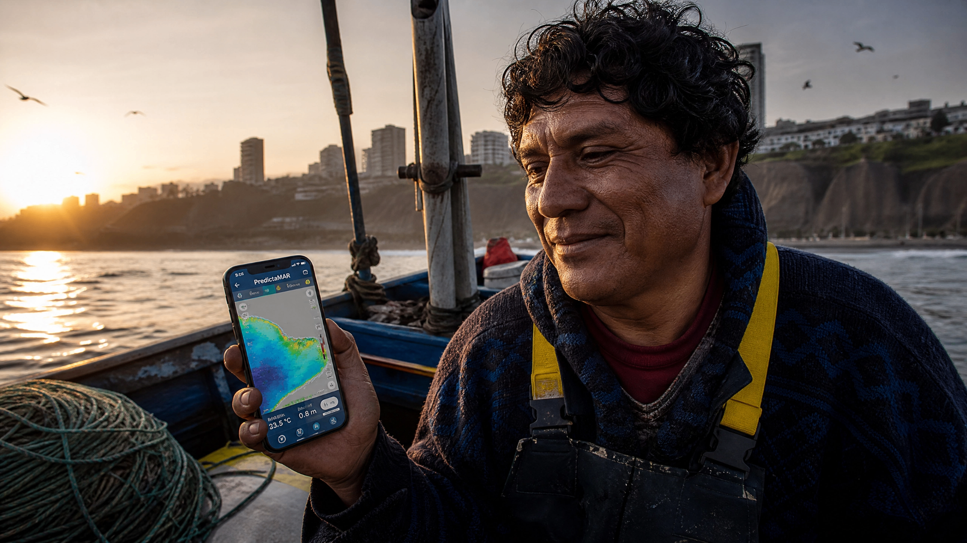
Artisanal fisherman using PredictaMAR on a vessel along the Peruvian coast
Field deployment · Lima, Peru
Input: Copernicus · NOAA · NASA
Output: MacroScore
Delivery
Cloud-native workflows
What we do

An operational prototype for satellite-informed decision support

PredictaMAR is an early-stage ocean intelligence platform that combines satellite constellations, Copernicus Marine Service data and AI-assisted scoring to support artisanal fishing decisions in the Humboldt Current System.

01

Multi-satellite processing

Optimized processing of satellite constellations, integrating Copernicus, NOAA and NASA datasets.

02

MacroScore methodology

A satellite-based, weighted and species-specific scoring system for artisanal fishing zone prediction.

03

Field-tested workflows

Validated through pilot deployments with artisanal fleets in Callao, Pucusana and Ancón along the Peruvian coast.

Capabilities

Oceanographic intelligence, built for scientific rigor

A field-tested methodology under active development, focused on transparent science and scalable deployment across artisanal fisheries.

Sub-kilometric analysis

Mesoscale oceanographic analysis at 1 km resolution to characterize coastal dynamics relevant to artisanal fishing.

Copernicus-based analytics

Copernicus Marine Service data integrated with NOAA and NASA products through an optimized multi-satellite pipeline.

Species-specific scoring

Currently supporting 10 target species in pilot operational workflows through a weighted scoring system.

Field validation

First field validation achieved with less than 20 meters of positional error under pilot conditions along the Peruvian coast.

Open science approach

Methodologies and results documented through peer-reviewed venues and open repositories such as Zenodo.

Cloud-native delivery

Optimized cloud workflows for a deployable operational prototype designed for artisanal fleets.

Live application

Launch PredictaMAR

Access the operational prototype of PredictaMAR — a cloud-hosted AI-assisted ocean intelligence interface for artisanal fishing zone exploration.

  • Interactive Copernicus-based ocean layers
  • Species-specific MacroScore visualization
  • Field-validated in Callao, Pucusana and Ancón
Launch ApplicationOperational prototype · Under active development
predictamar.streamlit.app
MacroScore · Anchoveta
SST
18.4°C
CHL
2.1 mg/m³
SSH
+0.12 m
Copernicus Marine · ingest pipeline · OK
Operational traction

Real, defensible metrics from early operations

PredictaMAR is in active pilot operations along the Peruvian coast, with measurable scientific and commercial traction.

Active fleet
24
artisanal fishing vessels in pilot operations
Early revenue
USD $320
monthly recurring revenue (MRR)
Field accuracy
<20 m
positional error in first field validation
Target species
10
supported in pilot operational workflows

Figures describe the current early-stage operational pilot of PredictaMAR along the Peruvian coast (Callao, Pucusana, Ancón). The platform is under active development.

Founding Team

The scientists building PredictaMAR

A founding team combining ocean intelligence, systems engineering and marine science, with active collaborations across European and Latin American institutions.

RY

Randy Yorry Warthon Velarde

Co-founder & Lead Researcher

Ocean intelligence architect. Leads satellite pipeline development, MacroScore methodology and strategic partnerships with INESC TEC Porto, CTN Spain and IMARPE Peru.

iD0009-0000-6557-5321
MV

Maik Valenzuela

Co-founder & Technical Lead

Systems engineering and operational infrastructure. Leads deployment architecture, data pipeline automation and integration with Google Earth Engine and Copernicus APIs.

iD0000-0002-4004-1793
SW

Samantha Warthon

Co-founder & Research

Marine science and field operations. Leads validation methodology, artisanal community engagement and data quality assurance across pilot sites in Callao, Pucusana and Ancón.

iD0009-0004-5997-0551
External Validation

Recognized by the international scientific community

PredictaMAR is being validated through international scientific venues, peer-reviewed journals, open repositories and active field engagement with artisanal communities.

1st Place — UNI Startup 2025

Top recognition at the Universidad Nacional de Ingeniería startup competition.

EGU 2026 — Oral presentation

Accepted for oral presentation at the European Geosciences Union General Assembly 2026.

Fisheries Oceanography (Wiley Q1)

Scientific paper currently under review in a Q1 peer-reviewed journal.

Copernicus Marine Service

Built on operational Copernicus oceanographic products.

Field validation — Peruvian coast

Pilot deployments and validation in Callao, Pucusana and Ancón.

Open science publication

Working paper deposited in Zenodo with persistent DOI.

Scientific Publications & International Recognition

Peer-reviewed and open-science contributions

PredictaMAR's methodology is documented through international conferences, peer-reviewed journals and open repositories with persistent identifiers.

EGU26-22690International Conference — Oral Presentation· Co-author

PredictaMAR: An integrated Copernicus-based decision-support platform for sustainable artisanal fisheries

European Geosciences Union General Assembly 2026 (EGU26) — Oral Presentation
EGU 2026 OralCopernicus-based PlatformOcean IntelligenceArtisanal Fisheries
View DOI10.5194/egusphere-egu26-22690
Zenodo PreprintWorking Paper / Scientific Preprint· Co-author

PredictaMAR: A satellite-based weighted and species-specific scoring system for artisanal fishing zone prediction using Copernicus Marine Service data

Zenodo — Open Science Repository
Scientific PreprintOpen ScienceSatellite OceanographyCopernicus Marine Service
View DOI10.5281/zenodo.19806218
Under ReviewPeer-reviewed Journal — Under Review· Co-author

Satellite-based decision support for sustainable artisanal fisheries in the Humboldt Current System

Fisheries Oceanography (Wiley) — Q1 — Under Review
Wiley Q1Peer ReviewFisheries OceanographyHumboldt Current
View DOIPending
Collaboration & Partnerships

Let's build ocean intelligence together

We collaborate with research institutions, public agencies, NGOs and partners working on artisanal fisheries and ocean sustainability.